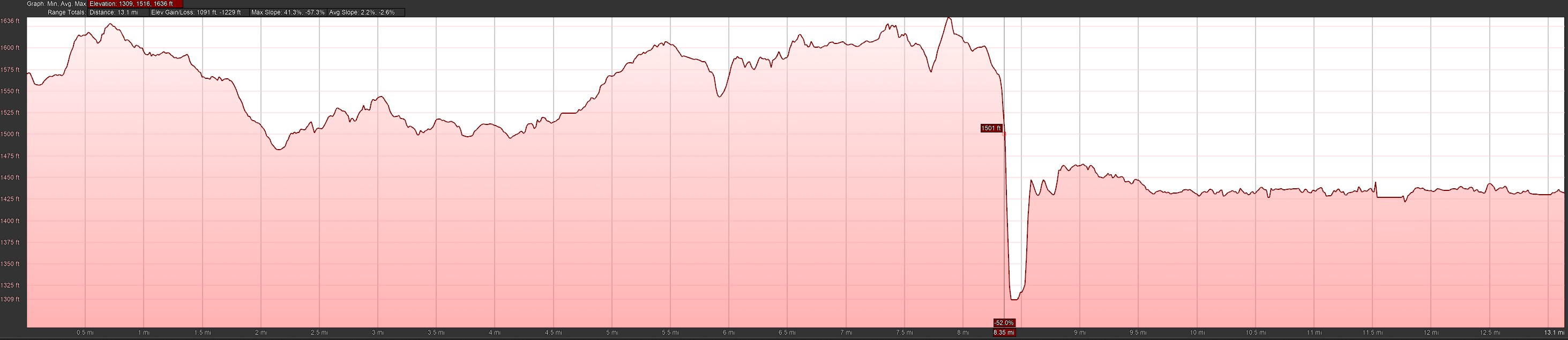
Below you will find a link to the Essentia Health Iron Range Half Marathon elevation profile. One item to note - with the bridge being relatively new, the satellite mapping doesn't pick it up, so the elevation change between 8.34 and 8.63 is off, it is a nice downhill slope but you don't actually run to the bottom of the pit. The elevation profile provided above was completed as the race was certified and more accurately reflects the elevation change across the bridge.